El Caminito del Rey: much more than a walkway suspended over the void. A complete guide to one of the most spectacular hikes in Andalusia.
Suspended between the towering walls of the Paraje Natural Desfiladero de los Gaitanes, in the heart of Andalusia less than an hour from Málaga, El Caminito del Rey is now one of the most spectacular routes in Europe.
For decades, it was known as “the world’s most dangerous walkway” — and that was no exaggeration. Today, after a long and careful restoration, it has become safe and accessible to many visitors without losing any of its charm.
The route winds its way through the municipalities of Ardales, Álora, and Antequera, suspended above deep gorges and vertical rock walls in a landscape that uniquely combines nature, industrial archaeology, and historical heritage.
I have to be honest: El Caminito del Rey was not in my plans. It was my aunt and uncle who insisted during a family holiday in Andalusia — they had read about this hiking route and didn’t want to miss it. I followed along somewhat sceptically and left with one of the memories I still treasure most today.
It’s a beautiful hiking trail, of course. But it is also much, much more than that — and discovering this is one of those pleasant surprises that only unplanned journeys can offer.
The official El Caminito del Rey website is very well designed, with virtual tours, practical information, instructions, and more. However, below you’ll find everything you need to know before setting off, along with the highlights you shouldn’t miss during the hike.
Here are some practical tips for organising your visit to the Caminito del Rey. The logistics may seem a little complicated, but knowing a few details in advance is enough to avoid rushing, delays and unpleasant surprises.
How to get to the Caminito del Rey
- By plane: the nearest airport is Málaga-Costa del Sol Airport, which is the main gateway for travellers arriving from abroad or from other Spanish cities. From the airport, you can reach Málaga on the C1 suburban train and then continue towards El Chorro from Málaga María Zambrano station. For more information about the airport, trains, buses and connections with the city centre, you can consult my section dedicated to Málaga.
- By car: this is the most convenient option, especially if you are travelling with your family or do not want to depend on public transport timetables. The Caminito del Rey is around 60 kilometres from Málaga and the journey normally takes just under an hour. You can leave your car in the official Visitor Reception Centre car park, near the northern access, or in the El Chorro area, close to the southern exit. The official car park costs approximately €2 per day and can be added when purchasing your admission ticket, subject to availability. Remember that the Caminito del Rey is not a circular route: you enter through the northern access, in the municipality of Ardales, and leave through the southern exit, in the El Chorro area. If you leave your car near the northern entrance, you will need to take the shuttle bus back to the car park after your visit. If you park in El Chorro, you will take the shuttle before your visit and, once you have completed the route, you will already be close to your car.
-
By train: this is a pleasant and affordable option for those travelling from Málaga. The station you should select as your destination is El Chorro-Caminito del Rey, located just a few minutes’ walk from the southern exit of the route.
From Málaga, there are Media Distancia connections and Proximidad rail services, with some C-2 trains extended as far as El Chorro.
To avoid mistakes, always search for the route from Málaga María Zambrano to El Chorro-Caminito del Rey on the
official Renfe website.
Timetables and frequencies vary depending on the day, so first choose compatible outward and return trains and only then book your Caminito admission time.
To compare available train times and options in a single search, I normally use
Trainline
and
TrainPal.
In any case, always check the Renfe website as well, especially to verify any last-minute service changes.
Once you arrive at El Chorro station, you will need to take the Caminito del Rey shuttle bus, which connects the southern exit with the northern access. The stop is located near the railway station and Hotel La Garganta. The shuttle will take you towards the Visitor Reception Centre or the El Kiosko area, from where the pedestrian paths leading to the control cabin begin. The shuttle costs approximately €2.50 per person, and the ticket allows you to use the service in either direction on the day of your visit. You can purchase it together with your admission ticket on the official website or directly on board. If you buy it on the bus, remember that payment is accepted in cash only and bank cards are not accepted. The service normally operates from 07:40 to 19:00 and the journey takes approximately 15–20 minutes. Before setting out, always check the latest information on the page dedicated to parking and the shuttle bus.
- By public bus: it is technically possible, but it is not the option I recommend. Services are less frequent than trains, may require changes and must be coordinated with your admission time and the shuttle bus. Moreover, once you reach Ardales or Álora, you will still need to arrange transport to the entrance. To check the available services, consult the Málaga Metropolitan Transport Consortium website.
- With an organised tour: this is the simplest option for anyone who does not want to worry about trains, parking, shuttle buses and connections. There are excursions with transport included from Málaga and several destinations along the Costa del Sol, including Torremolinos, Benalmádena, Fuengirola and Marbella. I always check the available options on GetYourGuide and Civitatis. Before booking, check that the price includes transport, admission to the Caminito, the shuttle bus and, where applicable, the guided visit.
Try to arrive well in advance: if you are travelling by car, aim to reach the parking area at least one hour before the time shown on your ticket. Many visitors underestimate the time required to park, wait for the shuttle bus and walk along the path leading to the control cabin. The time shown on your ticket does not refer to your arrival at the car park or bus stop, but to the time at which you must present yourself at the controlled entrance.
How to organise your visit to the Caminito del Rey
- Booking is practically essential: tickets can be purchased on the official Caminito del Rey website and tend to sell out quickly, especially at weekends and during spring and autumn. General admission costs approximately €10, while the official guided visit costs around €18. I recommend the guided visit because it allows you to better understand the history of the route, the geology of the gorge and the work required to restore the walkways.
- Book as soon as possible: do not wait until the final few days. As soon as your travel dates are confirmed, check availability and purchase your admission ticket. Remember to enter the participants’ details correctly and download the tickets to your phone before setting out.
- Check your booked time carefully: the time shown on your ticket refers to your arrival at the control cabin at the northern access, not your arrival at the car park, railway station or shuttle bus stop.
- The route is one-way: you enter through the northern access in Ardales and leave through the southern exit in the El Chorro area. If you have left your car near the entrance, at the end of the visit you can use the shuttle bus connecting the two ends of the route.
- Allow time for the access path as well: from the El Kiosko area, you will need to walk before reaching the official entrance. You can choose between two routes: the shorter one passes through the pedestrian tunnel, measures approximately 1.5 kilometres and takes around 20–25 minutes; the longer one begins near the El Kiosko restaurant, measures approximately 2.7 kilometres and takes around 35 minutes. Both lead to the same official entrance to the Caminito del Rey. You can find all the details on the official page dedicated to access and the route.
- A helmet is compulsory and is provided by the organisation after your ticket has been checked. You must wear it throughout the regulated section and return it at the end of the route.
- Pay attention to prohibited items: trekking poles, umbrellas, selfie sticks and particularly bulky objects are not allowed on the walkways. Before your visit, always check the mandatory rules and the official recommendations.
- It is not suitable for everyone: children under the age of 8 are not allowed to enter. Children who are permitted to enter must be accompanied by an adult and carry an original document proving their age. The route is not accessible to people with reduced mobility, and anyone who suffers from severe vertigo should carefully consider the visit.
- Check the weather conditions before setting out: the Caminito may close temporarily in the event of strong winds, heavy rain or other weather conditions considered dangerous. On the day of your visit, check the notices published on the official Caminito del Rey website.
- What should you put in your backpack? Read the The smart suitcase section carefully, where you will find all the items that are genuinely useful for completing the route safely and comfortably, while avoiding anything that is not allowed on the walkways.
When to visit the Caminito del Rey
- Spring, especially from March to May, is probably the best time to visit the Caminito del Rey: temperatures are generally mild, the landscape is green and the light is ideal for admiring the gorge and taking photographs.
- Autumn is also an excellent season, thanks to more pleasant temperatures than during the summer months. Weekends can still be very popular, so it is worth booking well in advance.
- Summer is possible, but requires a little more care. The route is very exposed and, on days when temperatures exceed 35°C, the heat can become demanding. Bring water, sunscreen and a hat, remembering that umbrellas are not allowed.
- Winter can also offer pleasant days, but wind, rain and conditions inside the gorge may increase the possibility of temporary closures. Always check the official updates before setting out.
- Whatever the season, I recommend booking one of the morning admission times. Temperatures are normally more pleasant, you will have more time to manage the train and shuttle bus, and the light will be better for admiring the landscape.
A brief history of El Caminito del Rey
El Caminito was not originally created as a tourist attraction.
In the early 1900s, in the area of El Chorro, the Sociedad Hidroeléctrica del Chorro built a major hydroelectric system in the heart of the Desfiladero de los Gaitanes gorge: power plants, dams, canals, and railway infrastructure. It was an impressive industrial landscape designed to bring electricity to Málaga and its province, which at the time was undergoing rapid modernisation.
To allow workers to move between construction sites along the vertical walls of the gorge, a first wooden walkway called Camino de los Balconcillos was built in 1901. It was narrow, exposed, suspended above the void, and served its purpose perfectly.
Construction of the hydroelectric plant began in 1903 under the supervision of engineer Rafael Benjumea, and the facility entered service in 1907. The original project also included a dam initially planned at 35 metres high, later increased to 50 metres to expand the reservoir’s capacity.
In 1921, the time came to officially inaugurate the Conde del Guadalhorce dam, and King Alfonso XIII personally chose to walk along the path during the ceremony. From that day on, local people began referring to it as “El Caminito del Rey” — the King’s Little Path. It is an affectionate name that has survived to this day.
As time passed and maintenance was neglected, the structure gradually deteriorated. Rotting wooden planks, missing railings, and rusting iron beams turned the route into a deadly trap suspended over the void. This is how it earned the nickname “the path of death“.
Despite hefty fines ranging from €6,000 to €30,000, many hiking enthusiasts continued to cross it illegally, attracted by the thrill of the risk. Between 1999 and 2000, four hikers lost their lives while attempting the route, forcing the authorities to officially close it and demolish the most dangerous initial section.
This period of abandonment is part of the legend of El Caminito del Rey and helps explain why its recovery was seen as such an extraordinary rebirth.
After years of proposals and discussions on how to restore the route to its former dignity, the Diputación de Málaga formally launched the restoration project in February 2014, investing approximately €6 million.
In March 2015, El Caminito del Rey officially reopened to the public — and the success was immediate.
The restoration completely rebuilt the walkway, making it safe and accessible once again, while preserving the memory of what had come before. Sections of the original structure are still visible from the new route, deliberately left in view for those who take the time to look closely.
The project did more than restore a path: it became an internationally recognised example of how industrial and landscape heritage can be recovered while fully respecting the surrounding natural environment. This commitment to the ecosystem — acknowledged through numerous awards — is also reflected in the daily visitor limit of 1,100 people, established to protect the flora and fauna of the gorge.
In short, El Caminito del Rey has gone from being an abandoned and dangerous piece of infrastructure to one of the most famous attractions in Andalusia. In every sense of the word, it is an extraordinary rebirth.
What you can see at El Caminito del Rey
Before setting off, I’d like to clarify something that many people overlook: El Caminito del Rey is not just about the famous suspended walkways. The complete hike — including the access and exit trails — is 7.7 km long, of which approximately 3 km consist of the actual walkways (including the new suspension bridge). The rest is a beautiful nature walk through native vegetation and local wildlife habitats.
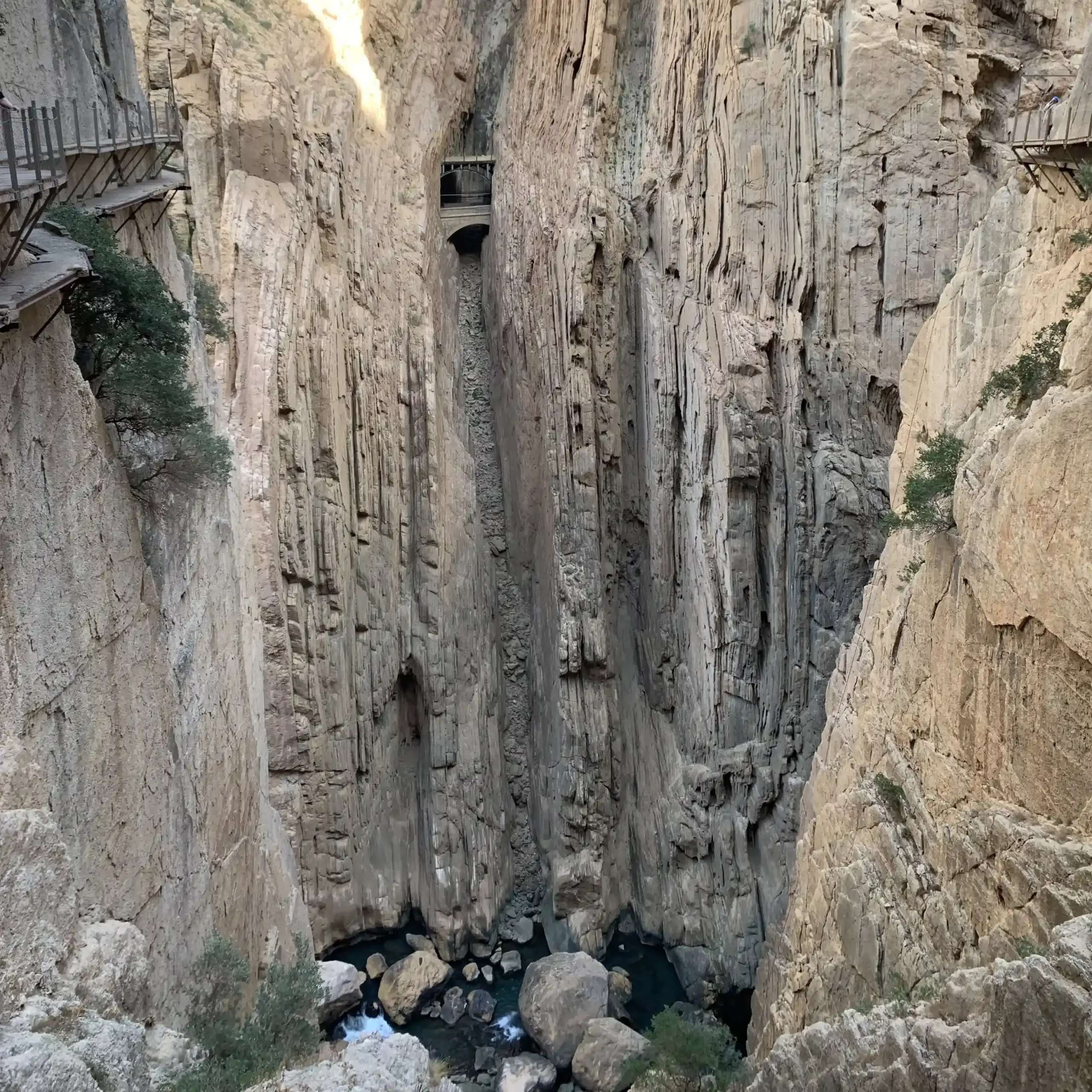
Don’t be intimidated by its old nickname. Today, the walkways are suspended up to 105 metres above the Guadalhorce River, with rock walls rising to almost 400 metres, but the route is completely safe, equipped with handrails, constant monitoring, and protective safety measures.
Here are the main highlights of the route:
1. The entrance and the Embalse del Gaitanejo
From the starting point, a short trail of about 15 minutes leads to a tunnel carved into the rock.
From there, you will reach the checkpoint, where you will need to show your reservation or ticket and collect your helmet. Once you pass through the gate, you are officially inside the famous El Caminito del Rey.
The welcome comes in the form of lush Mediterranean vegetation overlooking the Pantano/Embalse del Gaitanejo — one of those moments when you immediately realise this is not going to be an ordinary walk.
Shortly after setting off, you will come across the Sillón del Rey: a group of benches, a table, and a stone throne that, according to local tradition, King Alfonso XIII used while visiting the construction works. On the slopes opposite, along the Sierra Parda, you can spot cave houses carved into the sandstone. Some of them were inhabited by power plant workers until the 1960s.
2. First gorge: the Diga del Gaitanejo
About halfway through the green and scenic walk that follows the reservoir, you will reach the Diga del Gaitanejo. It is not open to visitors, but it is worth remembering that it is more than a century old.
A few hundred metres further on, the canyon narrows to less than ten metres in width. This is where the first wooden walkways begin, and beneath you the Guadalhorce River flows through hollows carved by swirling water that, over time, has sculpted the limestone into almost artistic shapes.
Along the canyon walls, you can still recognise the remains of the original structures: reinforced concrete and railway tracks, silent reminders of the workers who, a hundred years ago, built this route to transport materials between the dams.
3. El Soto and the Neolithic caves
Between the first and second gorges, the canyon opens into a wider basin. Here, evidence of human activity dating back to around 5000 BC has been discovered: pottery remains and traces of seasonal hunting that turn this section into a window onto prehistory, even before reaching the heart of the route.
4. Tajo de las Palomas and Puente del Rey
The second gorge along the route takes its name from the birds of prey that soar above it — Tajo de las Palomas, the Gorge of the Doves. This is where you’ll find the Puente del Rey.
In reality, it is a very simple and slender structure made of prestressed reinforced concrete that connects two sections of the canyon wall, but it was built by the workers who were employed here in the early 1900s.
From the bridge platform, you can clearly see the railway tunnels of the Málaga–Córdoba line, inaugurated in 1865: a colossal engineering project completed in just six years, featuring 17 tunnels and numerous viaducts.
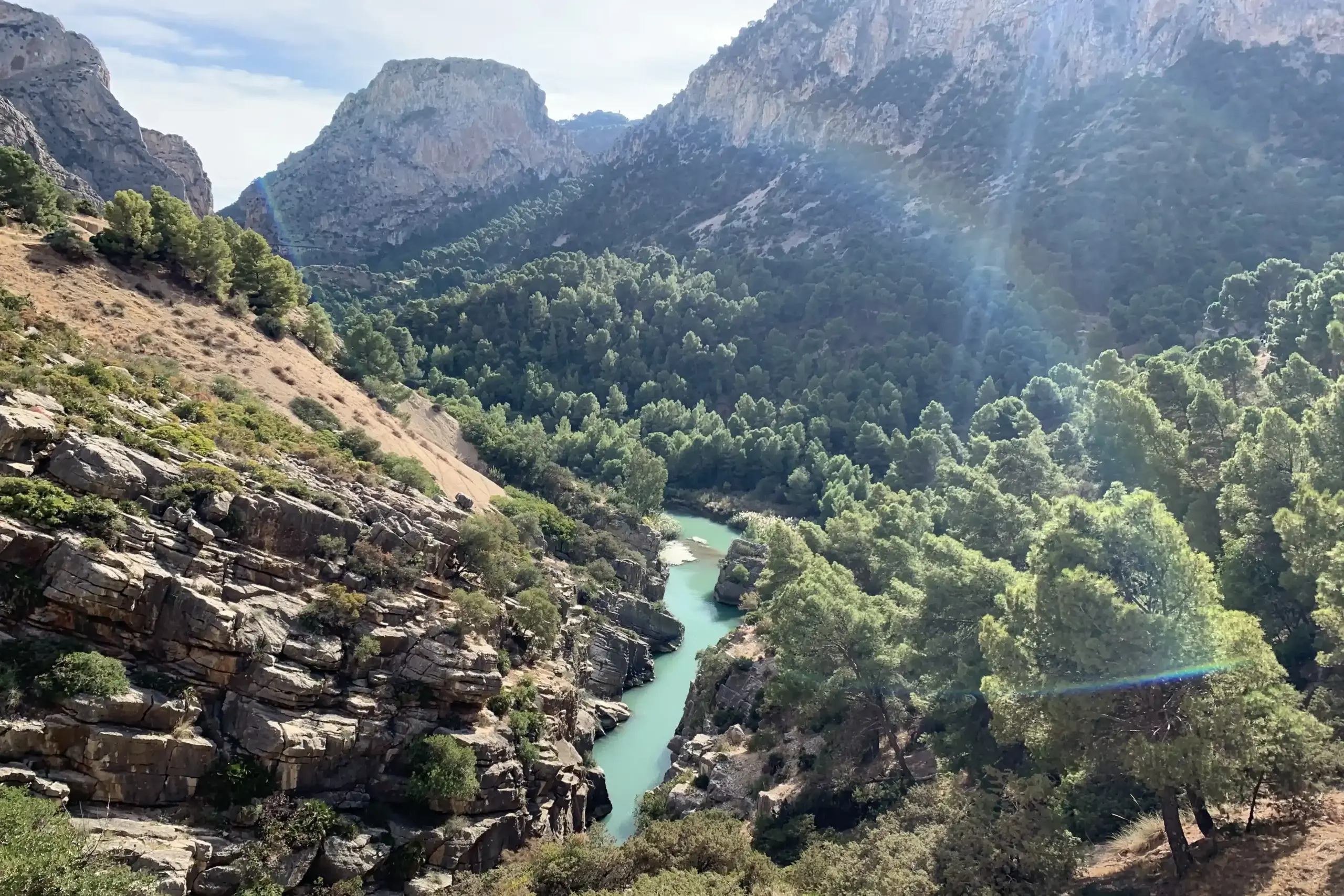
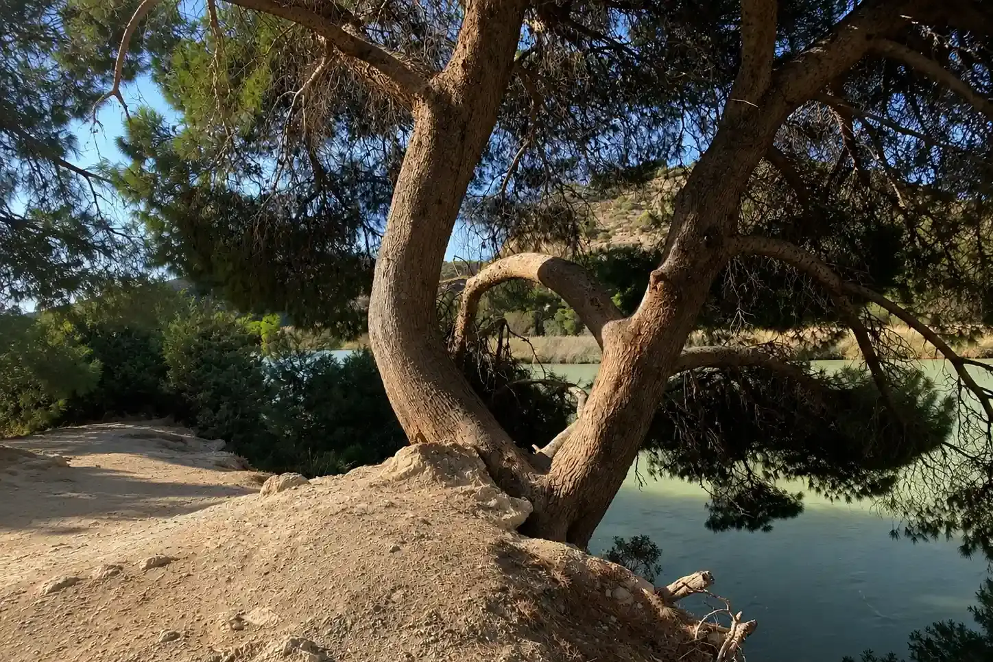
5. Valle del Hoyo
After crossing the bridge and continuing along the trail, the landscape changes dramatically. The canyon opens into a spectacular valley enclosed by limestone ridges, with dense forests and emerald-coloured waters that seem almost unreal after the sheer verticality of the gorges.
Here you will find the remains of the old sedimentation tanks — basins built to trap sediment — as well as a small pond known as Sapito Pintojo, which has now been adapted as a habitat for endemic amphibians.
Running alongside the trail are also various service structures, including hydraulic canals and pipelines connected to the Guadalhorce hydroelectric system, once used for maintenance access and drainage works. For part of the route, it is even possible to walk inside them.
A little further on stand the ruins of Casa del Hoyo, an old farmstead with orange groves irrigated by the historic canal.
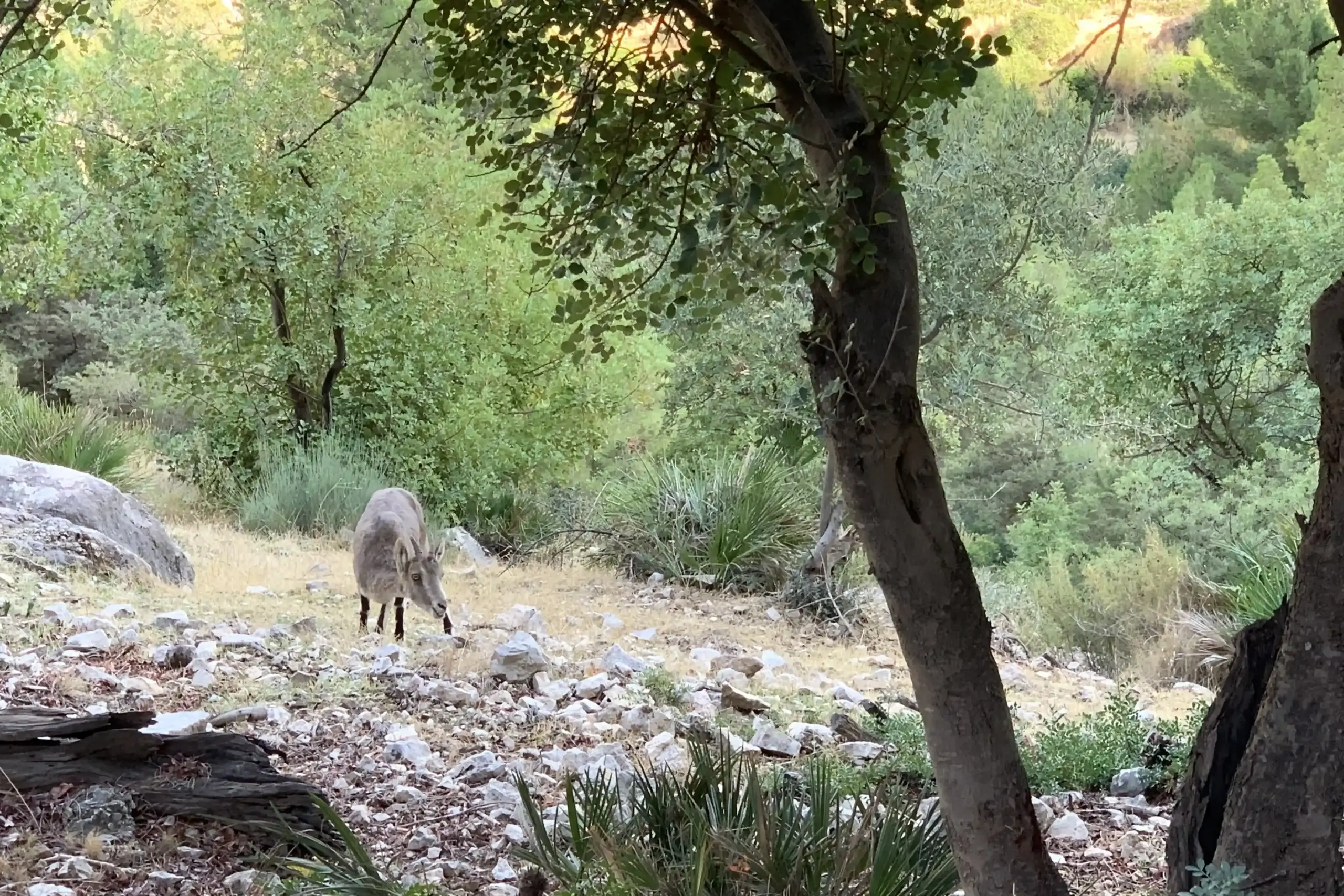
What impressed me most in this section, however, was the wildlife. Eagles, griffon vultures, falcons, Iberian ibex, wild goats, and hares.
Look around you — and above you. You will spot them half-hidden, quietly watching you with no intention of disturbing your visit. Return the favour by taking a photograph, but without trying to approach or disturb them.
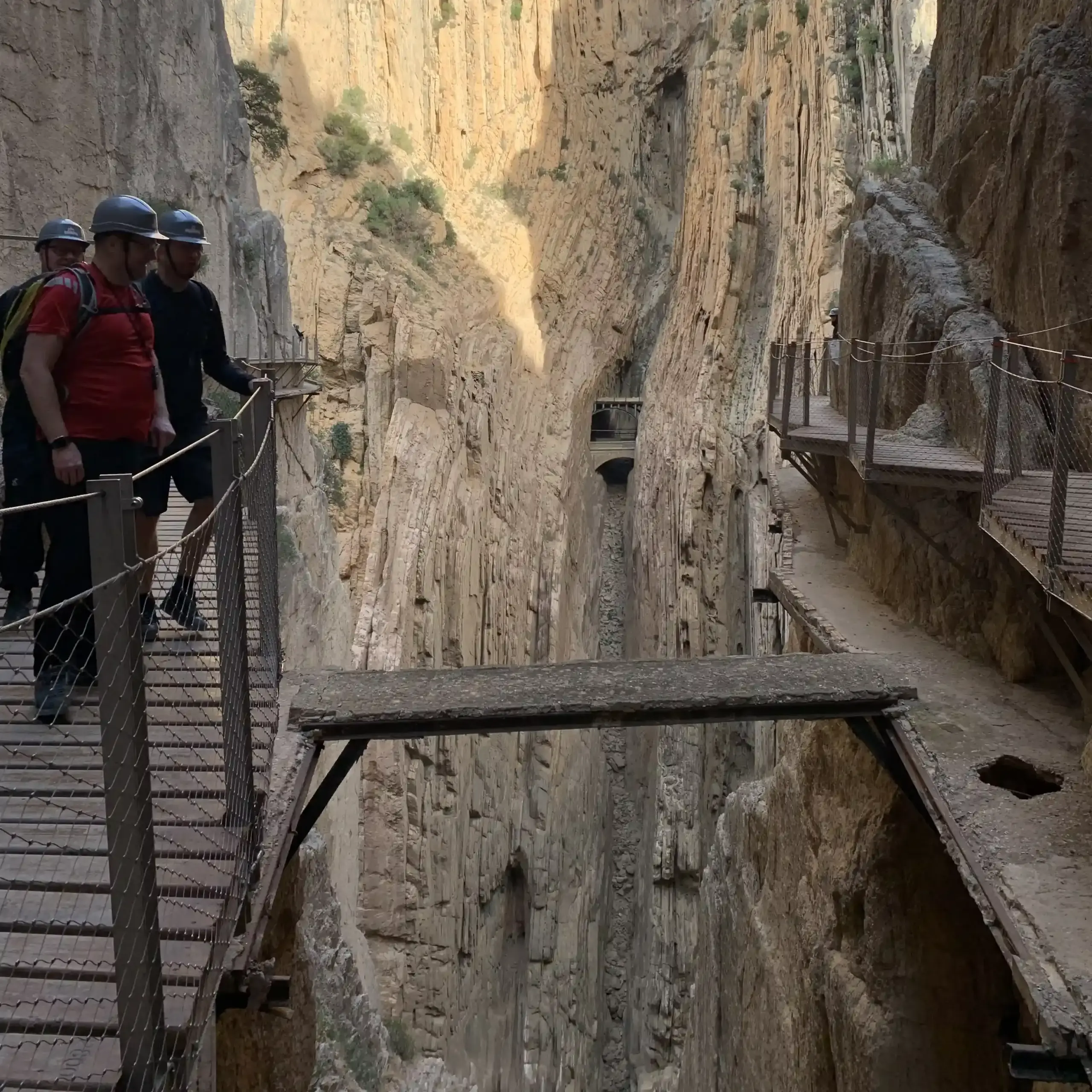
6. Third gorge: Gaitanes and the glass viewpoint
The final section brings back the full sense of verticality. The walkways run along the southern wall of the Gaitanes canyon, suspended around 100 metres above the water below. The landscape is brutal in the most beautiful sense of the word. It is also one of the places where the original route can be seen most clearly.
At one point, you will come across a glass-floored viewing platform where you can look directly into the abyss beneath your feet. While you’re standing there deciding whether or not to take a look down, remember to look up as well: on the Peñón del Cristo, you can make out cavities containing reddish sediments and archaeological remains dating back to the Bronze Age.
From here, you can enjoy a magnificent view of the famous suspension bridge.
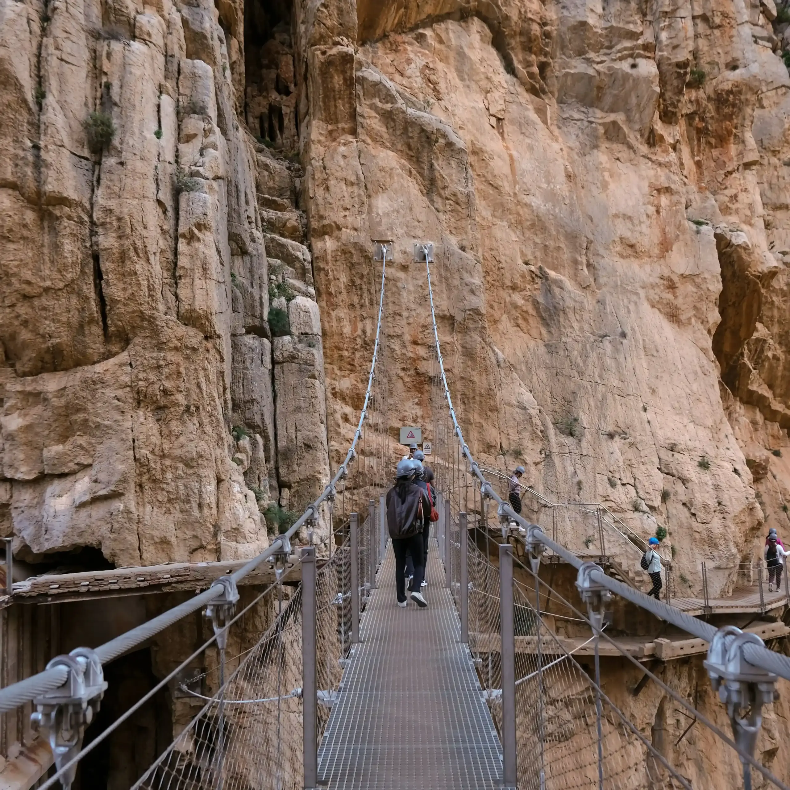
7. The suspension bridge, the symbol of El Caminito del Rey
The emotional highlight of the route is undoubtedly the Puente Colgante, the suspension bridge: a 35-metre-long metal structure that connects the two sides of the canyon at the point where the gorge reaches its greatest width and depth.
Its metal grating allows light and air to pass through. Crossing it provides the most intense sense of the gorge’s extraordinary scale and depth, as well as the most iconic view of the canyon.
8. The 2026 addition to El Caminito del Rey: Spain’s longest suspension bridge
Since 10 June 2026, El Caminito del Rey has had a new star attraction — and it’s no small addition.
At the final section of the tourist route, the longest suspension bridge in Spain has been inaugurated: 110 metres long and 50 metres high, built parallel to the old railway bridge still used by trains before they enter the El Chorro tunnel on their way to Álora.
Although the images you see online may look intimidating, there’s no need to worry.
The engineering tests carried out on the structure are as solid as the rock into which it is anchored. Before opening to the public, static tests were performed using 25,000 kg of weight distributed across the bridge in water-filled barrels, as well as tests involving 30 adults standing on the structure simultaneously to simulate visitor numbers during photo stops.
The most interesting part, however, involved the dynamic tests, designed to measure the bridge’s resistance to the effects of people moving across it and to reproduce expected visitor traffic. The first test involved 16 people marching in synchronisation — like a military parade — in order to place maximum stress on the structure. The second required 8 people to run back and forth repeatedly along the entire length of the bridge. In both cases, the bridge behaved exactly as predicted by the engineering calculations.
These tests confirmed its strength and reliability. In addition, to avoid any doubts, a network of sensors has been installed to continuously monitor structural variations, alongside 12 permanent surveillance cameras.
The construction project involved 20 specialist workers, 6 technical experts, and an equal number of structural engineers from different companies. Zip lines and helicopters were used to transport materials into a gorge that is inaccessible by road.
The real challenge, however, was the anchoring system. The upper layer of rock consists of an ancient compacted seabed, which is not ideal for supporting heavy loads. Suspended above the void, workers drilled shafts approximately 8 metres deep until they reached solid bedrock, then injected concrete to ensure a secure foundation. In addition, an arch-shaped structure made up of 64 pairs of 32 mm cables, manufactured in Switzerland, stabilises the entire span and eliminates oscillations.
The total cost of the project was approximately €1.5 million, funded entirely through revenues generated by El Caminito del Rey itself. Under its governing rules, a percentage of ticket income is continuously reinvested into infrastructure improvements.
Visitors who suffer from vertigo can still follow the original route, which runs alongside the canyon walls and remains open as a perfectly valid alternative.
The descent to El Chorro
Once you pass through the southern gate that marks the exit, the most exciting part of El Caminito del Rey comes to an end. However, a pleasant trail of around 2.1 km continues downhill towards El Chorro railway station, winding through eucalyptus trees and offering views of the Tajo de la Encantada dam. Enjoy the relaxing walk.
Once you reach the exit, if you left your car at the northern entrance, you can take the shuttle bus back to the starting point. If you arrived by train, you can simply head directly to El Chorro station, where your journey began.
A journey through time: when El Caminito del Rey was a seabed
El Caminito del Rey is not just an “adrenaline-filled” trail. Few people realise that it is actually a corridor suspended within a natural fracture of extraordinary geomorphological value — and understanding this completely changes the way you experience it.
Looking at the rock walls rising vertically for hundreds of metres, it is almost impossible to imagine that this very place was completely submerged beneath the sea around 180 million years ago. Yet that is exactly what happened: the limestone and dolomite rocks of the Desfiladero de los Gaitanes are of marine origin.
During the Jurassic Period, Andalusia and much of southern Europe were covered by a vast ocean known as the Tethys Sea, named after the Greek Titaness of the sea. Over tens of millions of years, the collision between the African and Eurasian tectonic plates gradually lifted this ancient seabed, giving rise to the mountains we know today as El Torcal de Antequera, Sierra Huma, and the gorges of El Caminito del Rey itself.
Learning to read the rocks as you walk is something you should not overlook if you want to experience El Caminito del Rey to its fullest.
Near the Diga del Gaitanejo, even before entering the first canyon, the rock walls tell a story spanning more than 150 million years of Earth’s history. It is worth looking up and trying to identify at least two different stories superimposed within the same cliff face.
You will notice dark vertical layers of limestone and dolomite. These date back to the Jurassic, around 180 million years ago, and formed in a deep marine environment. They were originally deposited as horizontal layers on the floor of the Tethys Sea. It was the collision between tectonic plates that rotated them into the vertical position you see today.
What was once a horizontal surface — the seabed — was transformed into a vertical wall by the immense force of tectonic movement. As the plates pushed against one another, the ancient seafloor underwent a ninety-degree rotation, and the result remains clearly visible to this day.
Further down, or in different sections of the route, you can instead recognise the conglomerates and calcarenites of the Upper Miocene, deposited more recently — relatively speaking — between 5 and 10 million years ago in a much shallower marine environment.
In essence, these rock walls are made up of pebbles, shell fragments, corals, and other marine organisms cemented together by turbulent waters. In other words, they are the remains of an ancient beach, where waves and currents rolled and rounded pebbles and marine sediments before binding them together into rock.
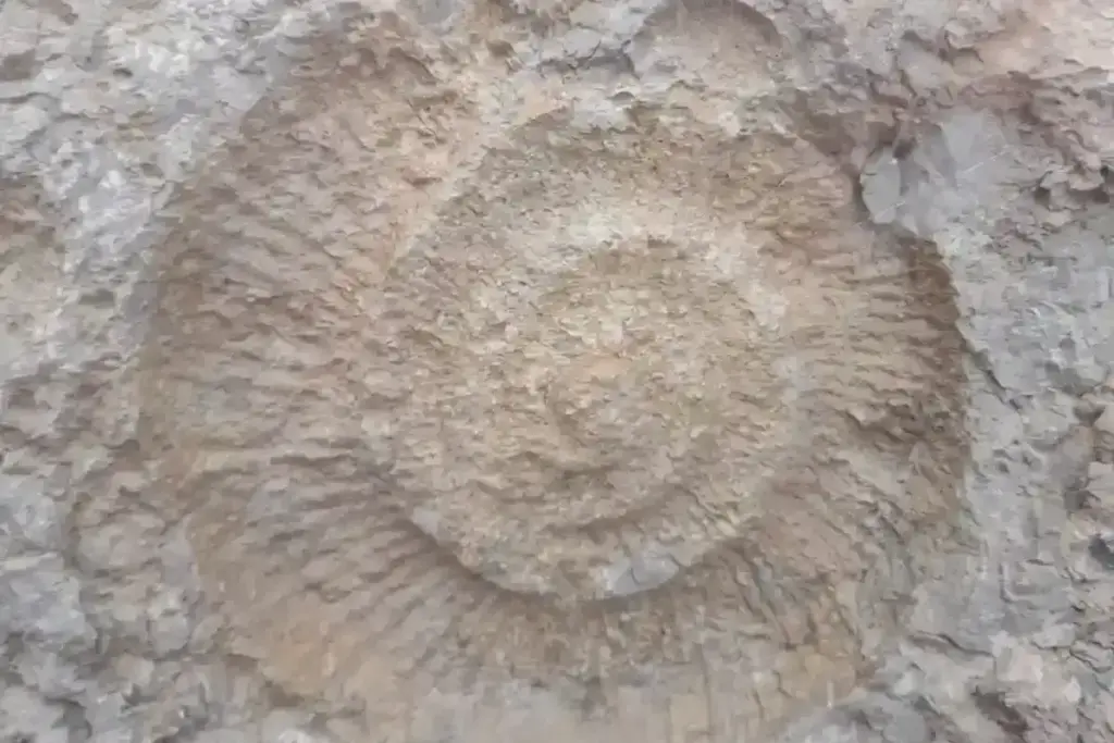
The most tangible evidence of this can be found in the ammonite fossils, which can be seen directly along the route, particularly in the final section of the walkways. These are the remains of extinct molluscs, distant relatives of today’s nautiluses — those marine creatures with spiral shells — and finding them more than one hundred metres above the ground on a vertical cliff face is perhaps the most surreal aspect of the entire hike.
During the restoration of the walkways, whale fossils were also discovered. Yes, you read that correctly. Within these rocks — now suspended above a canyon — researchers found the remains of large marine mammals, evidence of a sea that was once full of life.
The same geological phenomenon can be observed at the nearby Torcal de Antequera, famous for its spectacular karst formations and its abundance of ammonite fossils. If El Caminito del Rey has sparked your interest in this aspect of the landscape, El Torcal is the natural continuation of the journey.
The Caminito del Rey, although straightforward and well maintained, is still a hiking route. For this reason, when packing your suitcase, it is best to focus on bringing a comfortable, lightweight and practical backpack.
Your backpack should be small and compact: large backpacks and bulky bags are not allowed, as the route is narrow and partly follows suspended walkways. Many years ago, I was given a Mandarina Duck backpack that was quite small but surprisingly roomy. It is no longer available, but here I found a similar one.
Wear lightweight hiking shoes or sports trainers. Regular trainers are fine, but avoid shoes with smooth soles. Sandals, flip-flops and heels are unsuitable and may cause problems at the entrance.
A refillable water bottle containing at least 1-2 litres of water per person is also essential. There are no fountains or water refill points along the route, so you must carry all the water you will need. I bought a collapsible silicone bottle from Natura, although it is often unavailable. Alternatively, here you can find a similar one that takes up very little space once empty.
Add a hat, sunscreen and a few light snacks to your backpack, such as fruit, energy bars or juice. There are no refreshment points along the route and, even in winter, the sun inside the gorge can be intense. I always carry this sunscreen with me. It is small, but very effective. I have always brought a packed lunch as well, which I ate on the benches provided at the end of the route.
If the weather looks uncertain, bring a light rain jacket or windbreaker. It can be windy on the walkways, while the access paths may feel warm. I use this waterproof and windproof jacket, which is lightweight and takes up very little space. If you visit the Caminito in summer, a spare lightweight T-shirt can also be very useful.
Small items such as a power bank may seem like minor details, but they make the day much easier, especially if you use your phone for navigation, checking timetables and photographing the most beautiful parts of the route. I was given this one and I am very happy with it. Naturally, there are many different models available, but whichever one you choose, I strongly recommend bringing one.
Keep some cash for the shuttle bus with you as well: the fare is approximately €2.50 per person and it is best to have the exact amount.
Avoid bringing pushchairs, umbrellas, trekking poles, crutches and selfie sticks. Dogs are not allowed along the route either.
As you have probably realised by now, walking El Caminito del Rey is much more than a simple hike. It is a journey through the industrial history of Andalusia, following in the footsteps of workers and kings, while also discovering marine remains that are millions of years old.
Among all the excursions available around Málaga, El Caminito del Rey is one of the few that appeals to almost everyone: nature lovers, photographers, families, occasional hikers, and even people who do not normally enjoy walking.
It is a personal experience of courage and wonder, an immersion in a protected natural environment where griffon vultures soar above canyons hundreds of metres deep.
If you are spending a week on the Costa del Sol and would like to alternate a beach day with something completely different, El Caminito del Rey is probably one of the most memorable experiences you can have anywhere in Andalusia.
If you want to go beyond, read what to do on the Costa del Sol beyond the sea. The Costa del Sol has so much to offer: white villages like Frigiliana and Nerja, hiking trails on Sierra de las Nieves, and a few unusual places that are unlikely to leave you indifferent. There really is something for everyone, and each destination is perfect for a day trip.
Similar Posts
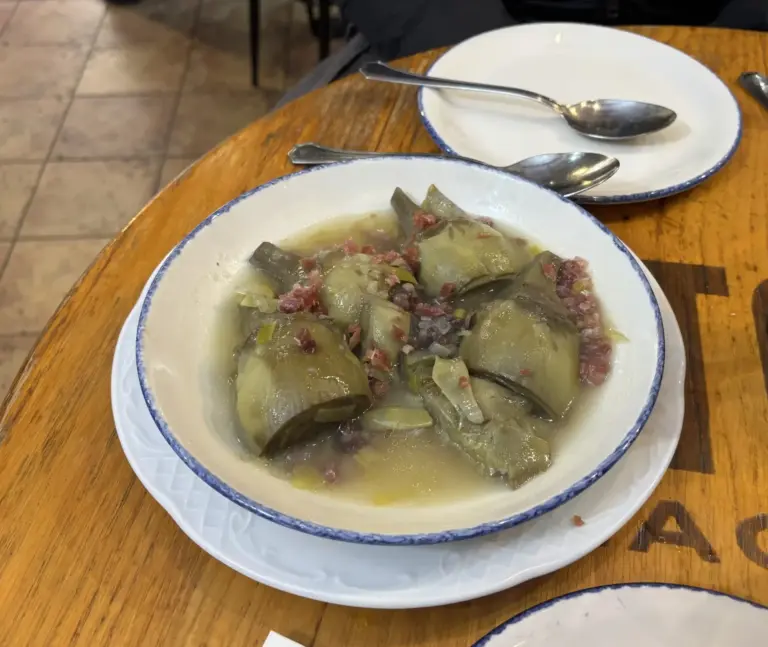
Flavors of Córdoba: where to eat in Córdoba between tradition and history
Flavors of Córdoba: where to eat in Córdoba between tradition and history I don’t know why — even today I still can’t quite explain it — but the first time I visited Córdoba I was in such a rush that I didn’t stop to eat. I grabbed something on the go between one visit and…
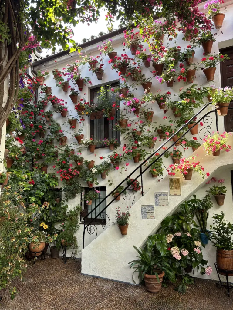
The Patios of Córdoba
As we’re getting closer to spring, I thought I’d write an article about one of the most beautiful spring events in all of Andalusia: the Fiesta de los Patios in Córdoba. If you’ve never been, get ready — it’s an experience you won’t easily forget. Patios are the inner courtyards of Córdoba’s houses. During the…
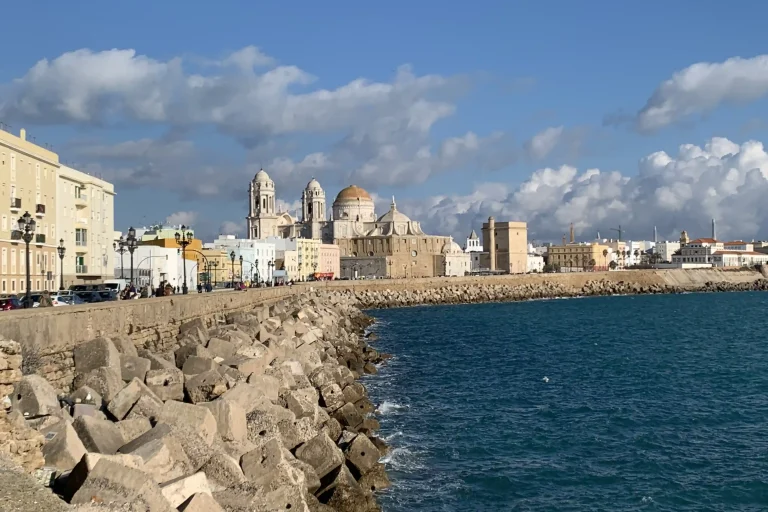
Cádiz: a city of distant riches, of light, of sea and of wind
Cádiz: a city of distant riches, of light, of sea and of wind Cádiz is a city immersed in a bright light, surrounded by the blue of the sea and crossed by a constant wind that makes it feel alive in every season. It is a city that has known distant splendors, thanks to its…
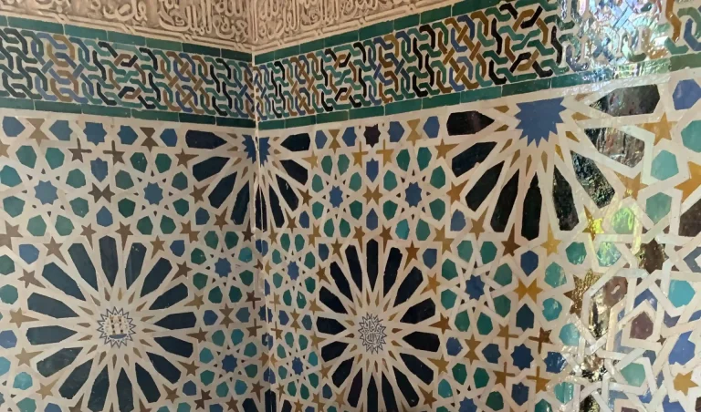
Andalusian splendor: exploring the home of flamenco and the joy of living well
Andalusian splendor: exploring the home of flamenco and the joy of living well A journey through Andalusia is not simply about arriving and visiting the most beautiful cities or the most famous landmarks.It is more a feeling that slowly takes shape: the changing light, streets that invite you to slow down, the sounds of bars…
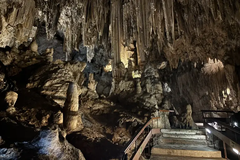
Cueva de Nerja: the underground giant of Andalusia between geology and prehistory
Cueva de Nerja: the underground giant of Andalusia between geology and prehistory Arriving in Nerja, visiting its beaches, and enjoying fresh fish in its restaurants is not enough if you haven’t seen its Cueva. Just a few kilometers from the town center, one of the most surprising places in Andalusia is hidden: the Cueva de…
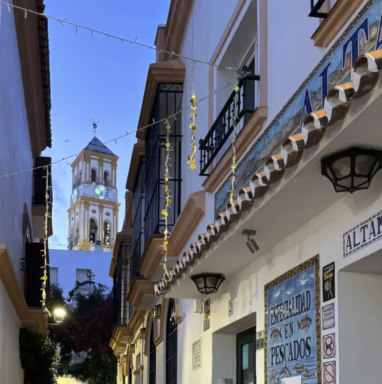
Costa del Sol beyond the beach: white villages, canyons and unusual places
Costa del Sol beyond the beach: white villages, canyons and unusual places When people think of the Costa del Sol, they all imagine the same thing: long beaches of fine sand, chiringuitos right on the shore and a sun that shines for more than 300 days a year. It is all true. But it is…