Río Verde in Istán and Charco del Canalón: the alternative to Río Chillar just outside Marbella
I have to admit it: Río Verde — or, more officially, the Istán–Charco del Canalón Trail — was not part of our original itinerary. We were spending a few days on the Costa del Sol during our trip through Andalusia, and at some point we felt like escaping the usual beach routine and heading out for a hiking excursion.
Some locals immediately recommended Río Chillar — the place everyone seems to suggest when you are looking for a water hike near Málaga. After hearing so many wonderful descriptions, we were already trying to decide on the best day to go when we discovered that Río Chillar is closed until further notice (and at the time of writing, access is still prohibited).
Once we got over the initial disappointment, we immediately started looking for an alternative that would allow us to keep at least part of the experience we had in mind, and that is how we came across Río Verde in Istán, just a few minutes from Marbella.
I have to say, it was a wonderful surprise!
We had also found the Paseo Fluvial de Benahavís, known for the striking Angosturas del Río Guadalmina. From what we saw, however, the route is more demanding (and probably even more spectacular) than Río Verde, and for people who are not particularly fit like us, it did not seem like the best choice. In addition, since summer 2026 access has been regulated with mandatory booking through the Benahavís Town Hall portal, with groups limited to a maximum of 10 people: it is no longer somewhere you can simply turn up on the spur of the moment, and it needs to be planned in advance. It is also highly recommended to do the route with a guide. Given our limited experience and the fact that we could not quite work out how the booking system worked — I have to admit the process is not particularly clear — we looked for local support: here is the link to the organised hiking excursion we had found.
In any case, if you are looking for an option that lets you combine a few hours of hiking, a beautiful white village, cool water and a welcome break from mass tourism all in the same day, Río Verde in Istán is a choice that will not disappoint.
Before telling you in detail about my experience along Río Verde to Charco del Canalón, I want to leave you here all the information I wish I had had in one place before setting off. These are the little practical details that, when planning an excursion like this, save time and, above all, help you quickly understand which route may be better suited to you.
- Where it is: in Istán, just a few kilometres from Marbella.
- Starting point we chose: Aparcamiento Charco del Canalón, near Vado de Bornoque.
- Length of the short route: around 4.5-5 km in total there and back, with some variation depending on the route you choose.
- Parking: small, unpaved and free, with space for roughly 10-15 cars.
- Two possible routes: you can follow the dry trail or choose the ruta acuática, walking directly through Río Verde.
- Difficulty: the dry route is definitely easier; the river route is more demanding, especially because of the slippery rocks and some deep sections.
- With children: I would mainly consider the dry route. Along the ruta acuática, there are points where the water is very deep.
- Highlight: Charco del Canalón, with its natural pool and distinctive waterfall.
- Booking and ticket: neither is required.
- Protected area: do not leave food scraps or rubbish along the route. This area is of great environmental importance and should be respected and preserved accordingly.
Be careful not to confuse it with another Río Verde: in Andalusia there is in fact at least one other Río Verde that is very well known among hikers, the one in Otívar, in the province of Granada, near Almuñécar . It is a completely different route, famous above all for the canyon carved into the limestone and its deep turquoise pools. If this is the Río Verde you are looking for, as always I suggest taking a look at the excursions available on GetYourGuide or the activities offered by Civitatis , where you can find several options for discovering Río Verde in Otívar.
The one I am talking about in this article, instead, is Río Verde in Istán, which rises in the Sierra de las Nieves, passes by the village of Istán and continues towards Marbella. So if you simply search for “Río Verde” online, be careful: the results often tend to mix up the two routes.
One final clarification: here I am talking about the short route that starts from the Charco car park. It should not be confused with the PR-A 280 Istán – Charco del Canalón, the official trail that starts directly from the village of Istán and is much longer.
How to get to Charco del Canalón – Río Verde in Istán
Getting there is fairly straightforward, as long as you use Google Maps correctly. Once you’re in the app, search for exactly “Aparcamiento Charco del Canalón”. Avoid searching for “Istán” or “Río Verde”: you risk running into misleading directions that will waste your time.
That said, always pay close attention to the roads your navigator suggests. This is because, contrary to what you might expect, Google Maps could offer you a route that’s anything but safe: a narrow, uncomfortable dirt track that we’d strongly advise against! We ended up taking it on the way back, and I can tell you we couldn’t wait to get there.
For the same reason, if after the walk you want to stop by Istán — which we absolutely recommend — don’t set “Istán centro” as your destination. Instead, set the Calle Calvario car park or “Aparcamiento Alto de Istán”: this way Google Maps will almost certainly route you along the safer, easier road, and it’s also a great spot to park without having to squeeze through the narrow streets of the town centre.
Río Verde: comparing the two routes
You can experience Río Verde in two very different ways: as a regular hike along a trail, staying mostly dry, or as a proper ruta acuática, walking directly along the riverbed. In this article, I’ll tell you about both.
Once you arrive at the “Aparcamiento Charco del Canalón“, expect the kind of car park you would imagine in a place like this: rustic, unpaved, with no barriers or ticket booth, and space for around 10-15 cars at most. The car park also provides access to several casas rurales, so be careful not to block the way.
Although it is small and not particularly well signposted, it is extremely convenient — as soon as you get out of the car, you will immediately hear the sound of the river, which is already a good confirmation that you are in the right place.
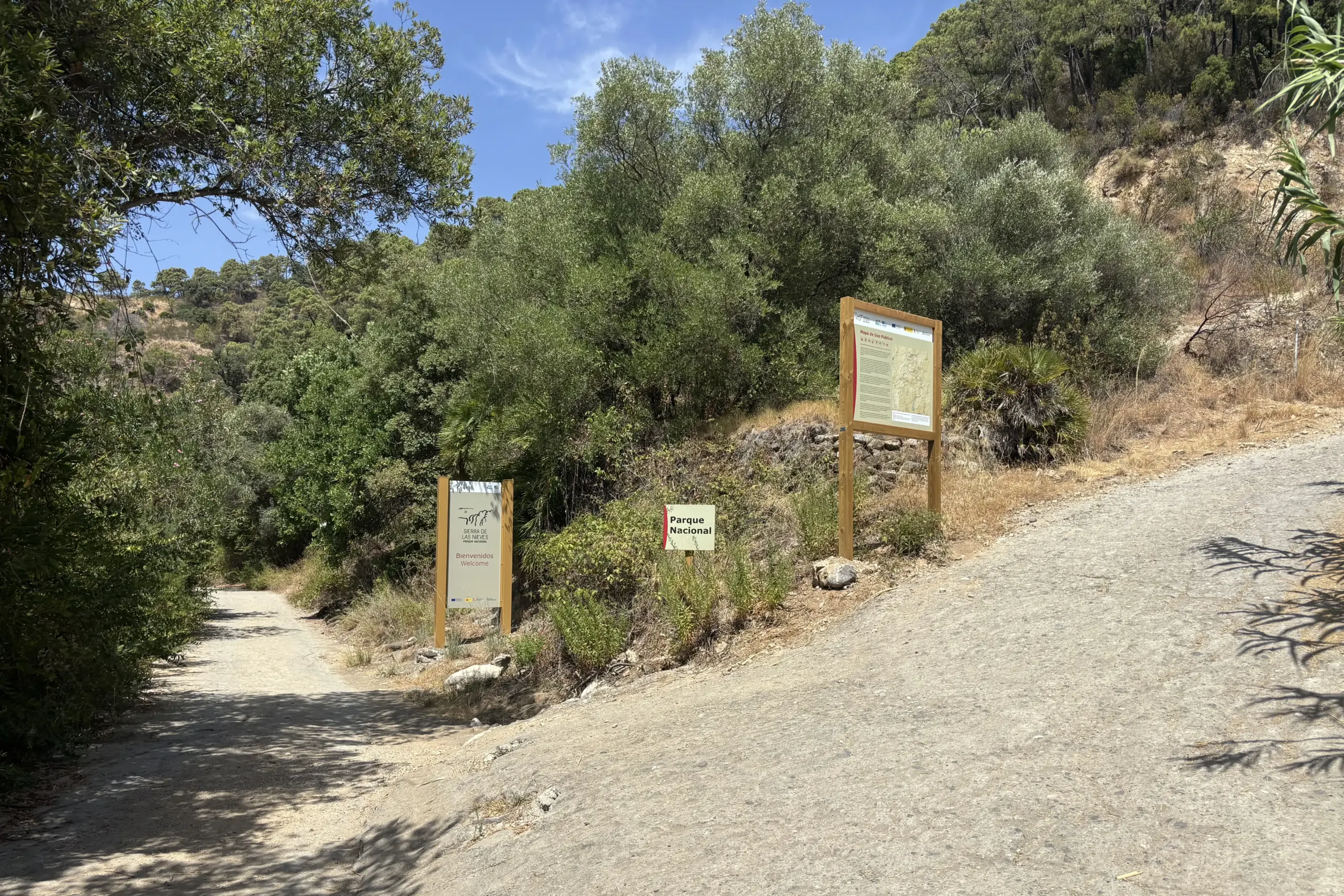
From there, just a few steps away, you will find the fork marked by a sign, the one that basically determines what kind of day you are going to have:
- on the right, the trail towards Charco del Canalón begins, following the dirt track
- on the left, the river route begins, the actual ruta acuática
As a general reference, bear in mind that the route is around 4.5-5 km in total there and back, with some variation depending on exactly where you leave the car and which route you choose to follow. I mention this because the signs you will see along the way often show different distances: they refer to the official Charco del Canalón trail, which starts from the village of Istán and is much longer, whereas the starting point I recommend — the Charco car park — is a few kilometres further on.
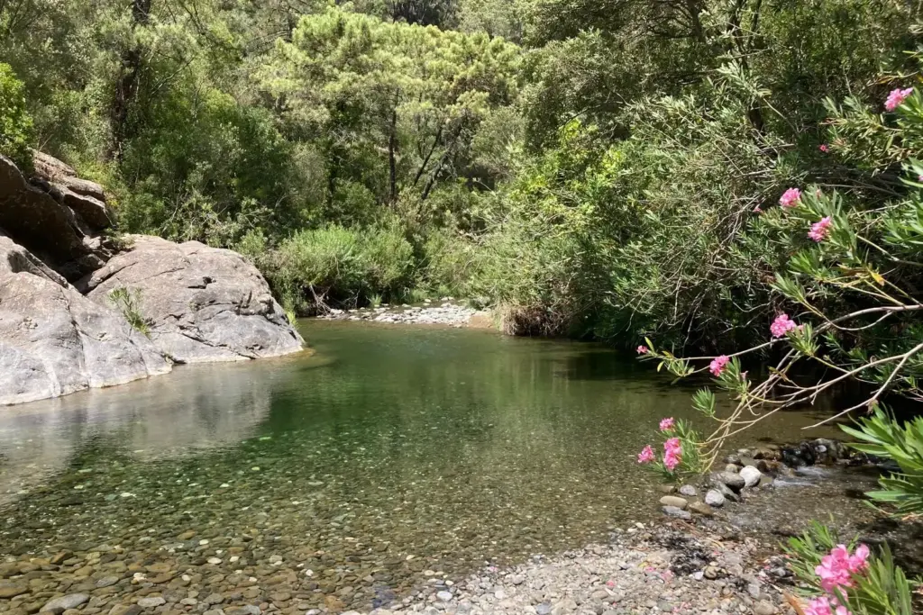
The river route: the most scenic (and the most tiring)
If you decide to take the path on the left, the one that follows the river all the way, be prepared: it is definitely the most scenic option, but also, I have to admit, the most demanding of the two.
Dress accordingly, because you will get wet: there is no dry section, apart from a few rocks sticking out of the river that make the walk a little easier by giving you some dry footholds. The first point where you can access the dry trail comes almost at the end, near the old suspension bridge — but by then you will already have reached the most scenic part, so there would be little point in leaving the river right there.
A note for those travelling with children: the water is not very deep everywhere, but in some places even someone 1.80 m tall cannot touch the bottom. You need to be a confident swimmer — this is not a section to take lightly.
The main problem, however, is not the depth: it is the rocks. The rocks covered in algae and moss are extremely slippery — the downside of that green effect we appreciate so much in the river.
That said, walking through the river is absolutely worth it. There are plenty of beautiful spots, and compared with walking along the dry route, you do not suffer from the heat — quite the opposite, it is a genuinely refreshing experience, perfect during a holiday under the hot sun of Andalusia and the Costa del Sol.
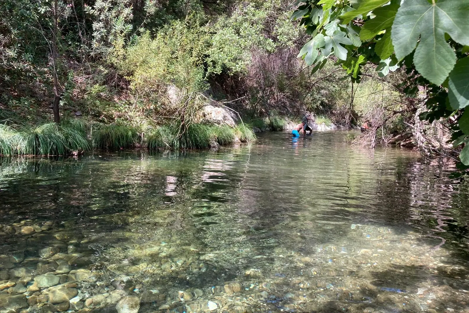
The water is beautiful and crystal clear, the kind that makes you want to jump straight in. In August, the temperature was practically perfect: cool, but not cold. All around you there is vegetation, dragonflies, the occasional butterfly and flowering oleanders — it is not a manicured place, but it is definitely natural and far removed from the heavily developed coastline. We even met a little dog that followed us for the entire route, probably coming from one of the rural houses near the river. The surrounding scenery is pleasantly green — even the mountains enclosing the valley offer beautiful views, with tall, lush trees.
Access from the car park is via the Vado de Bornoque, a section that makes it easier to enter the water.
From there, the route continues for several kilometres, alternating between very different sections:
- sections where the water reaches just above your ankles, easy and quick to walk through
- sections where it rises up to your torso, where you need to walk carefully or almost swim
- sections where the riverbed forms a series of small natural steps, creating tiny cascades one after another
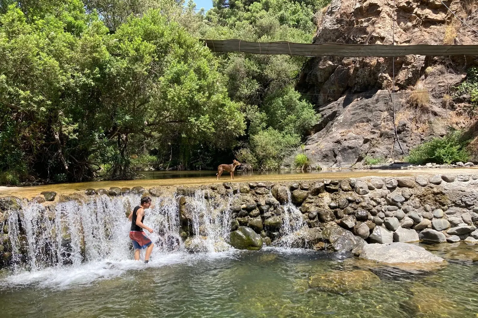
…until you reach the abandoned suspension bridge: it is still there, but in a very poor state of repair — almost “abandoned to nature”.
This spot — which also corresponds to another ford, useful for accessing the various casas rurales in the area — forms a beautiful natural pool with a small waterfall. One of the most scenic moments of the entire walk.
According to some historical sources, it was precisely along this stretch of the river that an episode took place in 1506 that was far less idyllic than the experience you will have here — an attempted escape by the Morisco population of Istán towards North Africa, intercepted here by troops from Marbella.
It is a detail you will not find on any sign along the trail, but it gives a completely different meaning to the place where you are about to cool off.
As you continue, you will come across another natural pool, deep in the centre but very easy to access from the sides. You will find it hard to resist: taking a dip, perhaps simply floating while you admire the surrounding nature, is a must.
Around the pool, and more generally along the entire river, grow oleanders, poplars, fig trees and willows; and as you walk or enjoy a refreshing swim, you will be surrounded by small freshwater fish, the occasional pond turtle, and plenty of birds and dragonflies.
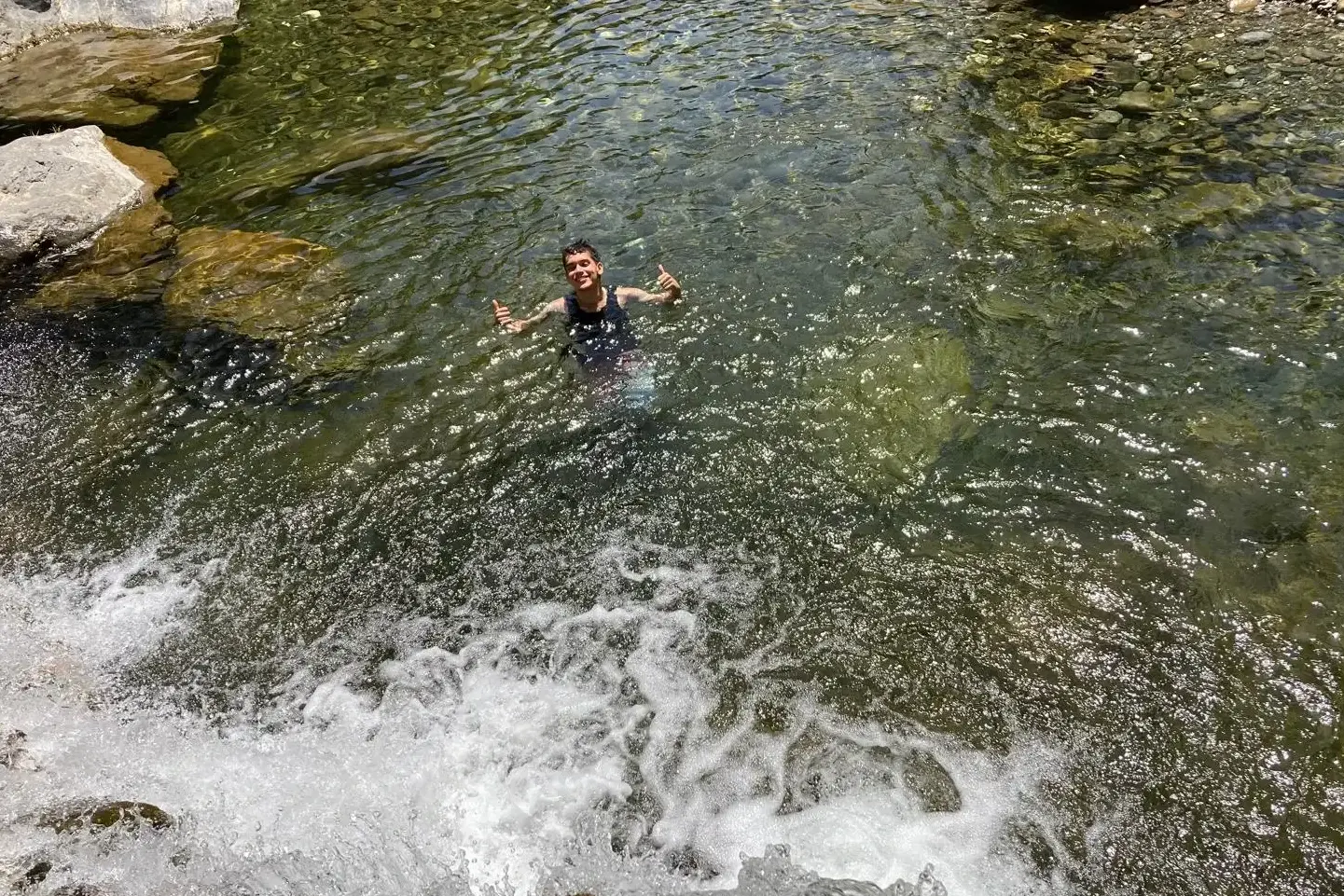
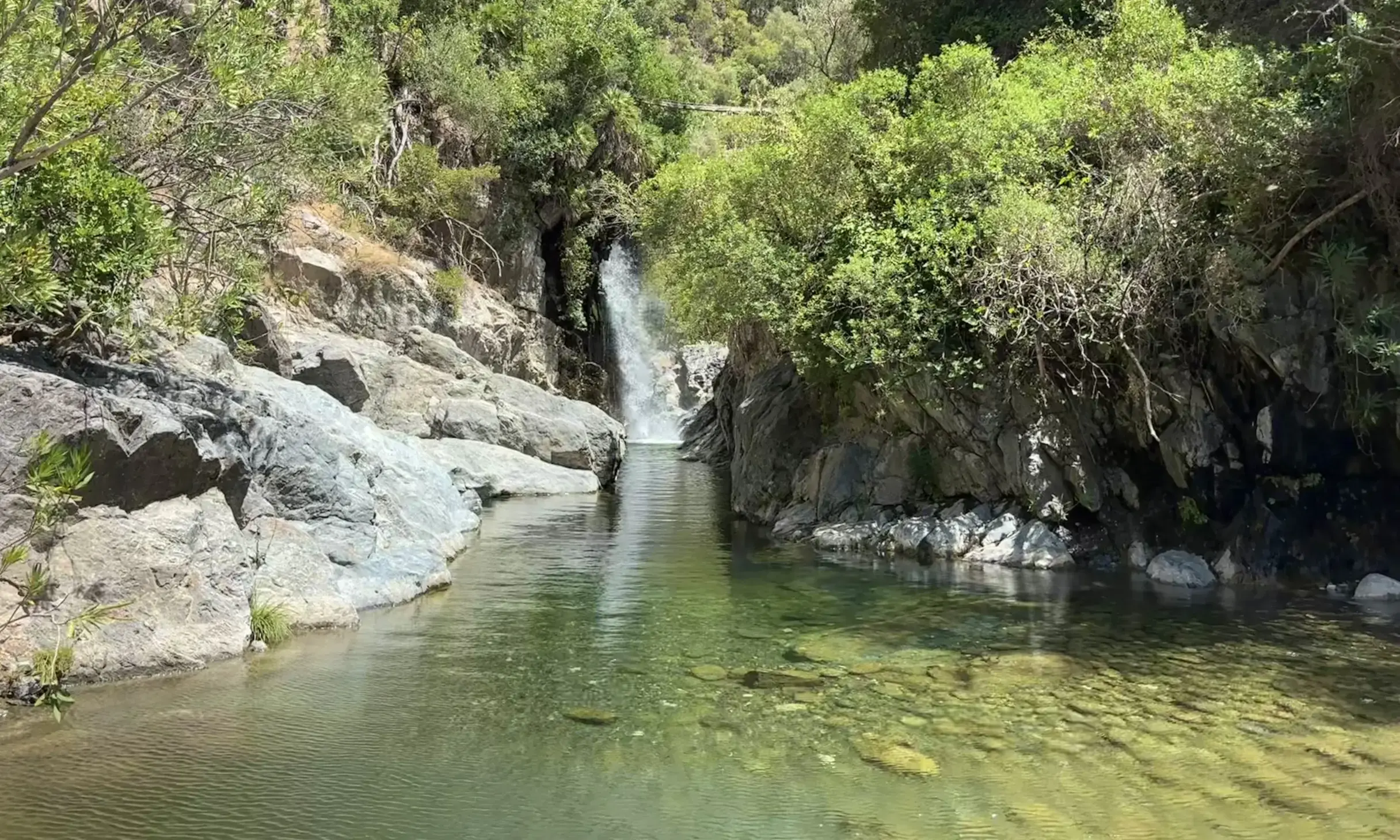
Just after this, once you have passed the rocky walls, you will reach Charco del Canalón — the highlight of the entire route. It is a natural pool carved over time by Río Verde, enclosed by white limestone walls that create a beautiful contrast with the intense green of the water; if you manage to climb a little higher along the trail, the view from above is even more impressive.
Above the charco runs an old water channel, an acequia, and this is where the characteristic waterfall that drops into the pool comes from — hence the name “Canalón”. However, this waterfall is not entirely natural and, unfortunately, it is not constant: it depends on the water flowing through the channel, so you may find it with very little water or even without the spectacular drop seen in many photos online.
The entire Canalón landscape is crossed by acequias and water channels, built to carry water from Río Verde to farmland and rural properties. Canalón itself takes its name from a water channel located above the gorge; the Diputación de Málaga confirms that the characteristic waterfall comes from an acequia located a few metres higher up.
It is therefore very plausible that the suspension bridges I mentioned were used not only for the everyday passage of local residents, but also to reach and maintain the hydraulic infrastructure, inspect the acequias and move between properties on both sides of the river.
The good thing is that you can reach all these spots — the suspension bridge, the Charco and the waterfall — while staying mostly dry, by following the dirt trail I describe below.
Before moving on to the dry section, though, I have to tell you two things with complete honesty. First: we chose the river route and, every now and then, partly because we were tired, we gave in to a bit of exploration and tried to find drier alternative paths along the riverbanks. I really do not recommend it — there are no proper trails, they are a little dangerous and full of brambles, and they are more likely to complicate your day than help.
Second: I will not pretend that doing the entire route along the river is easy — it is quite demanding, and we were definitely tired by the end. A good compromise, therefore, could be to skip the full ruta acuática, follow the dry trail instead and enter the river only once you reach the Charco.
The dry route: a convenient option
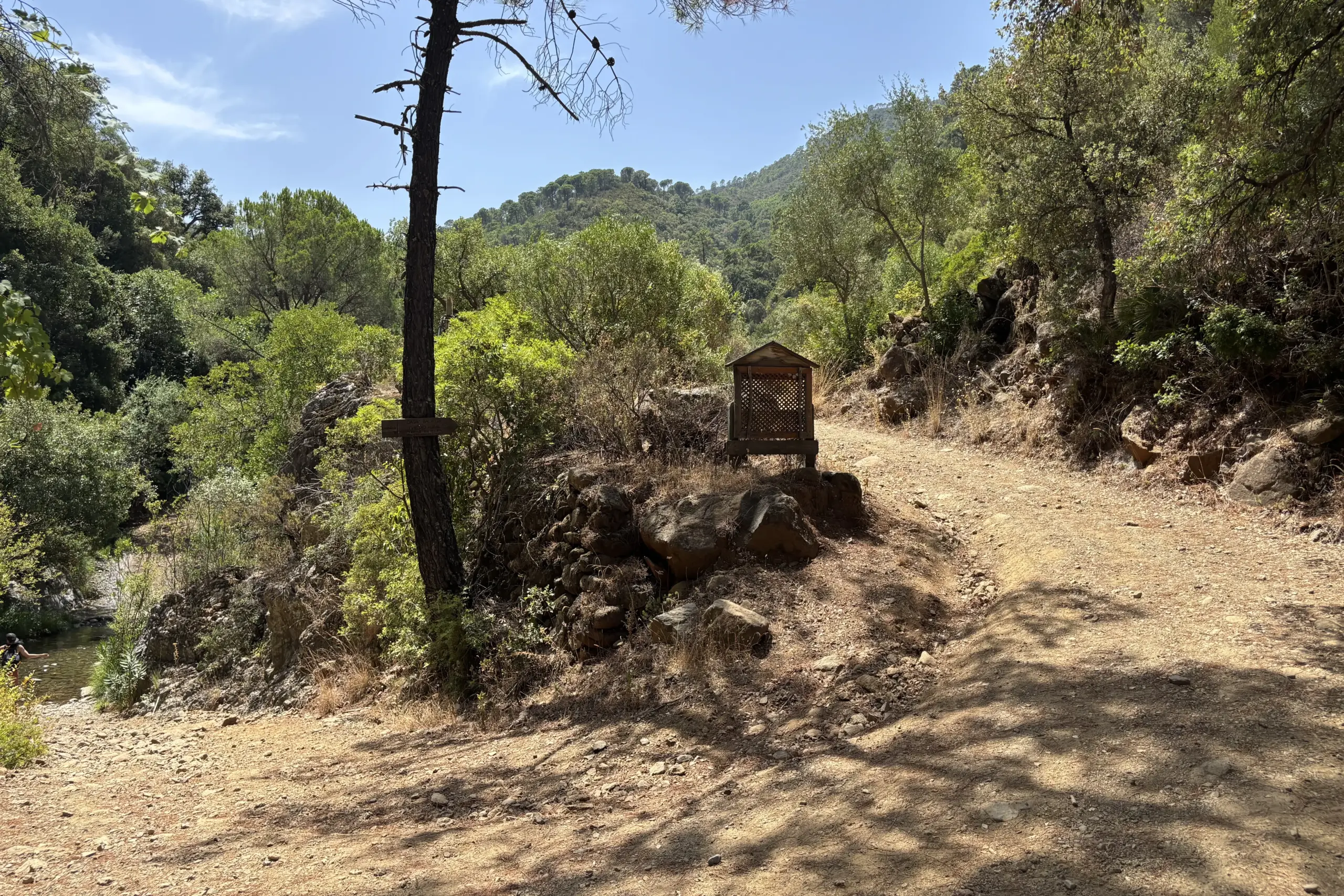
If you do not want to get too wet, or you prefer something a little less tiring, choose the dry trail route — the official one — towards Charco del Canalón. At the fork you reach after parking, simply do not follow the sound of the river: at the sign, turn right and continue along the dirt track.
The route is comfortable and easy to follow from the start. Some sections are still unpaved and it is not exactly shaded, especially at the beginning, so if you do it in the middle of summer under the midday sun, make sure you bring enough water.
If your aim is to see the river up close, bear in mind that this is not the most scenic route in that sense: it stays away from the river for much of the way. On the other hand, you will pass through lovely stretches of cork oak woodland (alcornoques), with pine trees and junipers — the vegetation is lush in places, and this is one of the nicest sections to photograph while walking.
The route is well signposted, both with official signs and with others that are a little more “rural” — and do not worry: if you take a wrong turn, in the worst-case scenario you will end up in front of a private property where access is prohibited, as happened to us. You simply need to retrace your steps and get back onto the right route.
A website that helped us a lot on this route was gpsmalaga.com: we relied on this guide to get our bearings when, at one point, we were not entirely sure where we were. It explains all the forks and landmarks along the route very clearly.
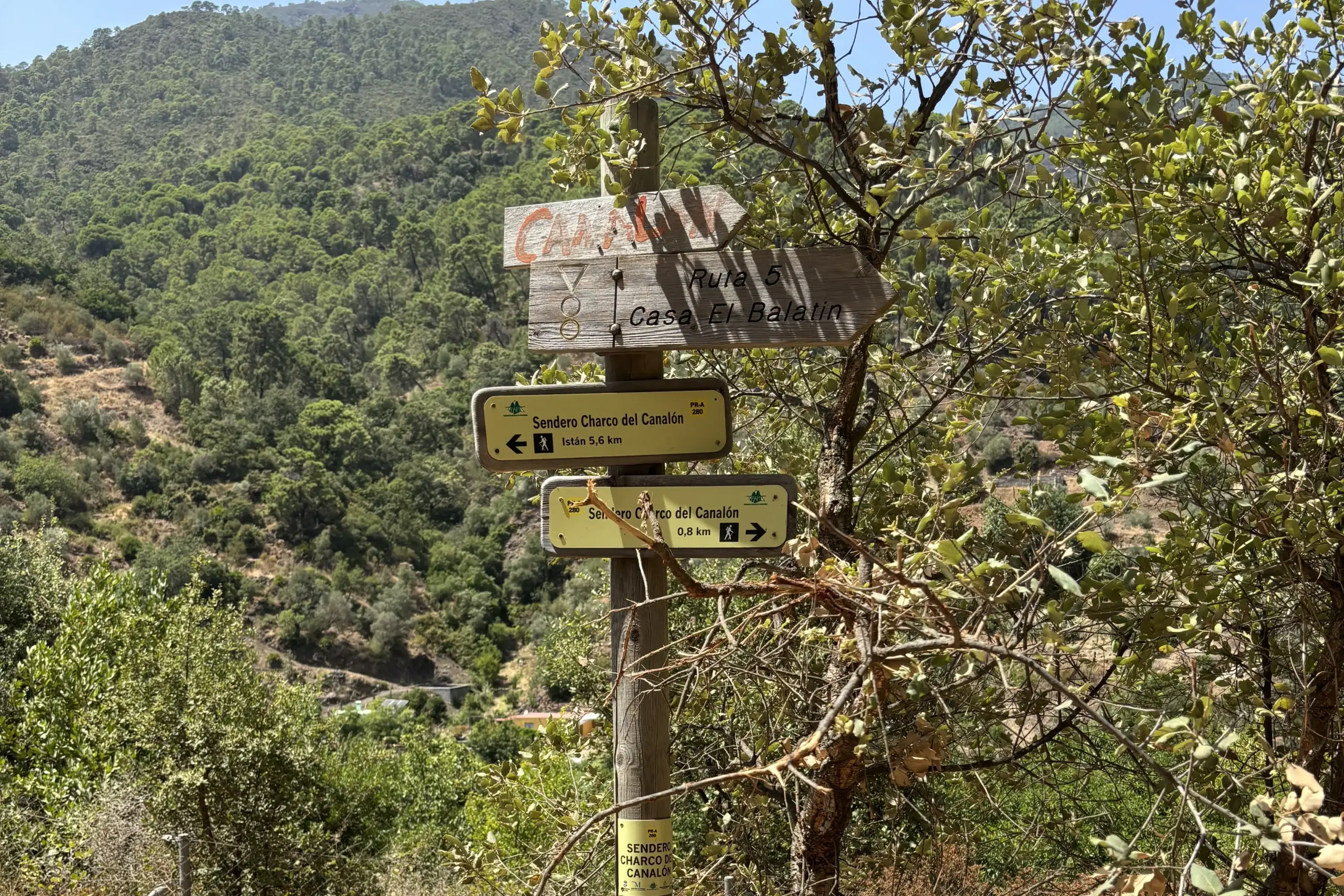
In any case, after about 2 km from the start of the trail — with a few more or less intentional detours through the wooded section — you will reach a fork:
- to the left, the route leads towards the old abandoned suspension bridge — and this is the option we recommend. Be aware, though: along this section towards the river you may come across a closed gate. If you can get around it, perfect; if the passage is not accessible, unfortunately you will have to give up and continue along the dirt track — but don’t worry, because at the end of the unpaved section you will still reach the best part of the experience.
- continuing straight ahead, instead, you will follow the final section of the official trail along the track, until you reach the point marked as Casa Balatín.
Along the route, especially near the charco, you will also find the remains of other suspension bridges that once crossed the river.
From what I have been able to piece together, bridges like this were probably used to allow local residents and workers to cross Río Verde even when the ford was impassable, connecting the agricultural properties scattered along both banks.
The reason for building a suspension bridge instead of a normal small bridge was perfectly logical: Río Verde has a highly variable flow. In summer it may look like a relatively calm watercourse, but after heavy rainfall its flow and water level can rise considerably. A small bridge resting on the riverbed would have been much more vulnerable; a suspended crossing, on the other hand, allows the two banks to be connected while leaving the riverbed unobstructed.
This is not information that we have been able to confirm through a solid historical source, but only from comments by some travellers and an acquaintance — whether true or not, I still like to consider it a very plausible hypothesis.
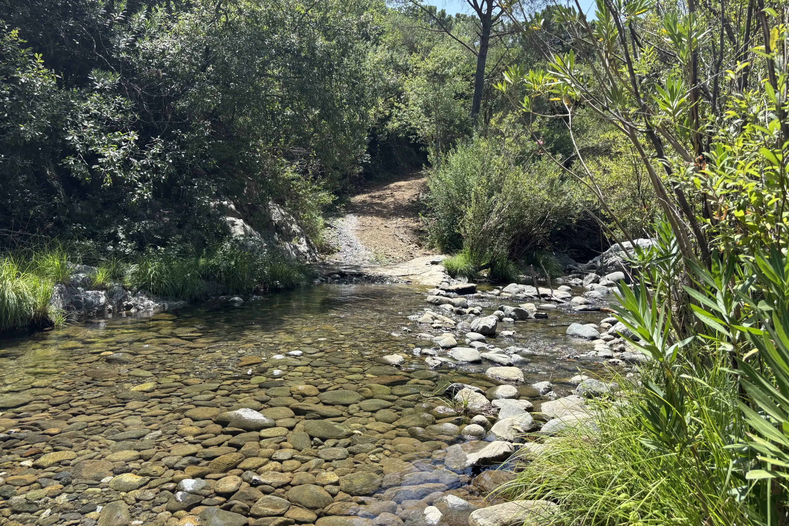
Continuing along the main trail, at a certain point you will need to cross the river via the Vado de Balatín and reach the opposite bank, then follow the dirt track. Almost immediately, you will come to another fork — to the left the route leads towards Casa Balatín (rural accommodation), while to the right, partly hidden by vegetation and not particularly well signposted, a small sign points towards Charco del Canalón.
Following this route, you will reach the small natural pool I mentioned earlier — deep in the centre but manageable along the sides — and from there, by climbing over the rock, you will find yourself face to face with Charco del Canalón and its waterfall.
The great thing about this spot is that, besides giving you access to the most scenic part of the route, you can also enjoy a short walk through the river, following the direction of the current — so heading downstream rather than upstream — as far as the suspension bridge: essentially retracing, in reverse, the same section you would cover if you chose to walk entirely through the river from the car park.
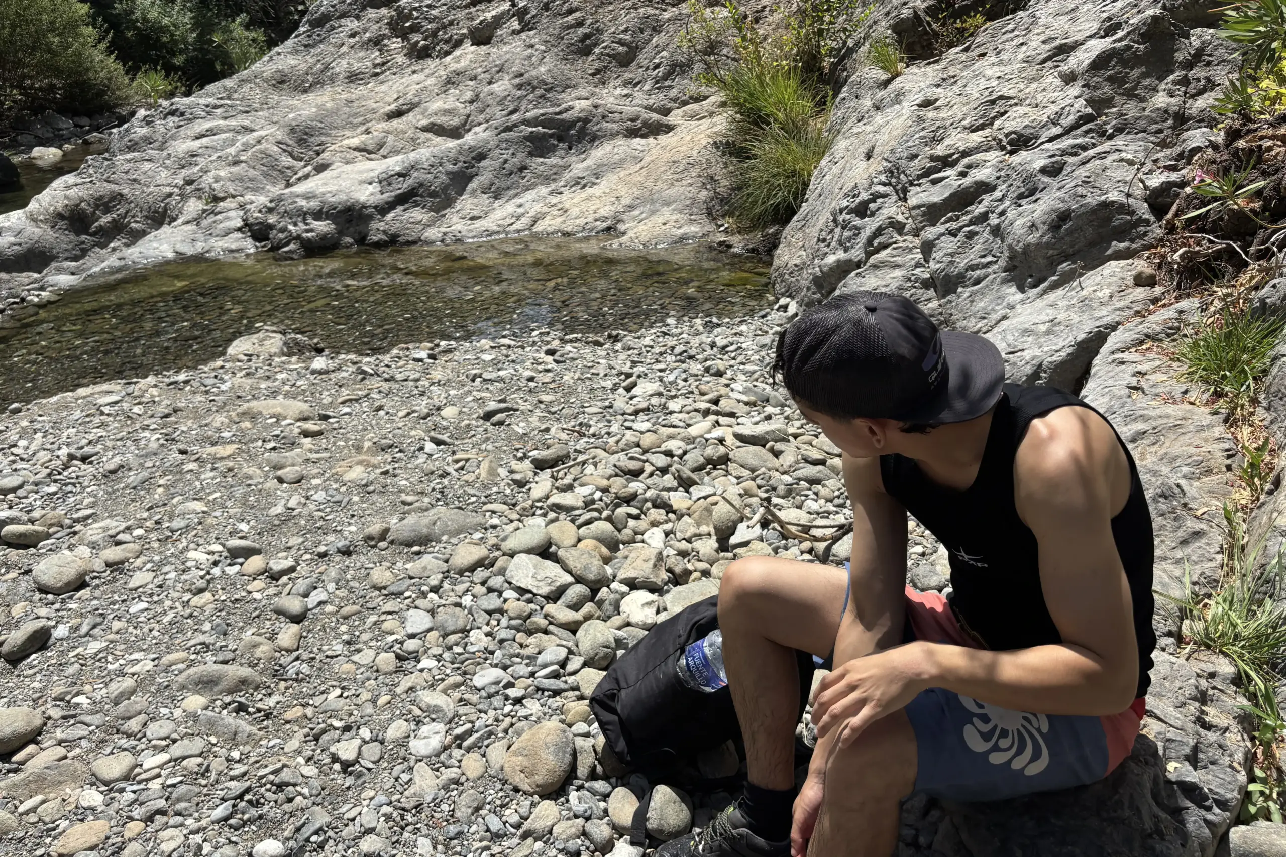
Just remember that if you found the gate closed at the previous fork, from here, to return to the car park via the dry trail, you will need to enter the river again and head back to the Balatín trail access you came from — or, alternatively, continue all the way along the river following the current.
The real advantage of the dry trail is its practicality: it allows you to reach the most beautiful spots along the river comfortably, even with children, without having to get wet right from the start.
Of course, by doing this you will miss out on what really makes the difference: walking through the river is what turns this day into a true water hike, rather than just a walk that ends at a natural pool. You will still be happy with what you see, but the experience will be different.
Whichever route you choose, you should know that walking along Río Verde means literally walking along the boundary between two protected natural areas of exceptional ecological and geological value: the river in fact marks the southern boundary between the Sierra de las Nieves Natural Park and Sierra Bermeja.
Within just a few kilometres, the landscape shifts from limestone to peridotite, deep igneous rocks originating in the Earth’s mantle and brought to the surface by tectonic movements. This is no minor detail — Sierra Bermeja is in fact home to one of the largest and most extensive peridotite outcrops in the world , a true geological rarity on a global scale.
The official PR-A 280 Istán – Charco del Canalón route
What I have described so far — starting directly from the Charco car park, at Vado de Bornoque — is the so-called short route to Charco del Canalón. The official route, the PR-A 280 Istán – Charco del Canalón, starts instead directly from the village of Istán, in the Plaza del Cha area, and reaches the charco along tracks and trails through the countryside and the Río Verde valley. The Town Hall describes it as follows: 7.2 km one way, a linear route with medium difficulty — so if you complete the whole route from Istán, you should allow for around 14.4 km there and back.
It is the route I would choose if the aim were to go on a proper hike and get to know the landscape around Istán in depth. But it is not the route we did: we “limited ourselves” to parking at the Charco and following the shorter trail I described above — which is also, it has to be said, the most scenic section.
If you are interested in the Sierra de las Nieves, you should know that in 2026 the Diputación de Málaga launched — with funding of almost €600,000 — a new trail from Istán, which will even include a new suspension bridge of almost 100 metres over Río Verde.
Be careful, though: we are not talking about the same route I have described so far. The project includes a trail of around 13 km connecting the historic centre of Istán with the Castaño Santo, along a route of great scenic value. The new bridge will make it possible to cross Río Verde in complete safety, while also offering new viewpoints over the surrounding landscape; the route will also include natural viewpoints towards the Embalse de la Concepción and stretches of Mediterranean vegetation typical of the area.
The Castaño Santo is a monumental chestnut tree, one of the oldest in the entire province of Málaga: it is estimated to be between 800 and 1,000 years old, with a circumference of more than 13 metres. It is located in the area known as Hoyo del Bote, and local legend says that beneath its branches, in 1501, Ferdinand the Catholic celebrated a thanksgiving mass during the suppression of the Morisco revolt in Sierra Bermeja — and that the prayers even asked for twilight to be delayed, to help the troops make a discreet approach towards Marbella.
A fascinating legend, certainly, but it remains just that: no documented historical source confirms it.
To reach it today, while waiting for the new trail to be completed, you can take the Istán–Castaño Santo cycling route directly from the village, or start from San Pedro Alcántara, passing alongside La Quinta Golf Club. It is mostly a dirt track and is also suitable for children.
If you want all the practical details of the route, this Wikiloc track describes the experience step by step. In any case, you can also find plenty of information on the Istán Town Hall website .
What to see in Istán after the hike
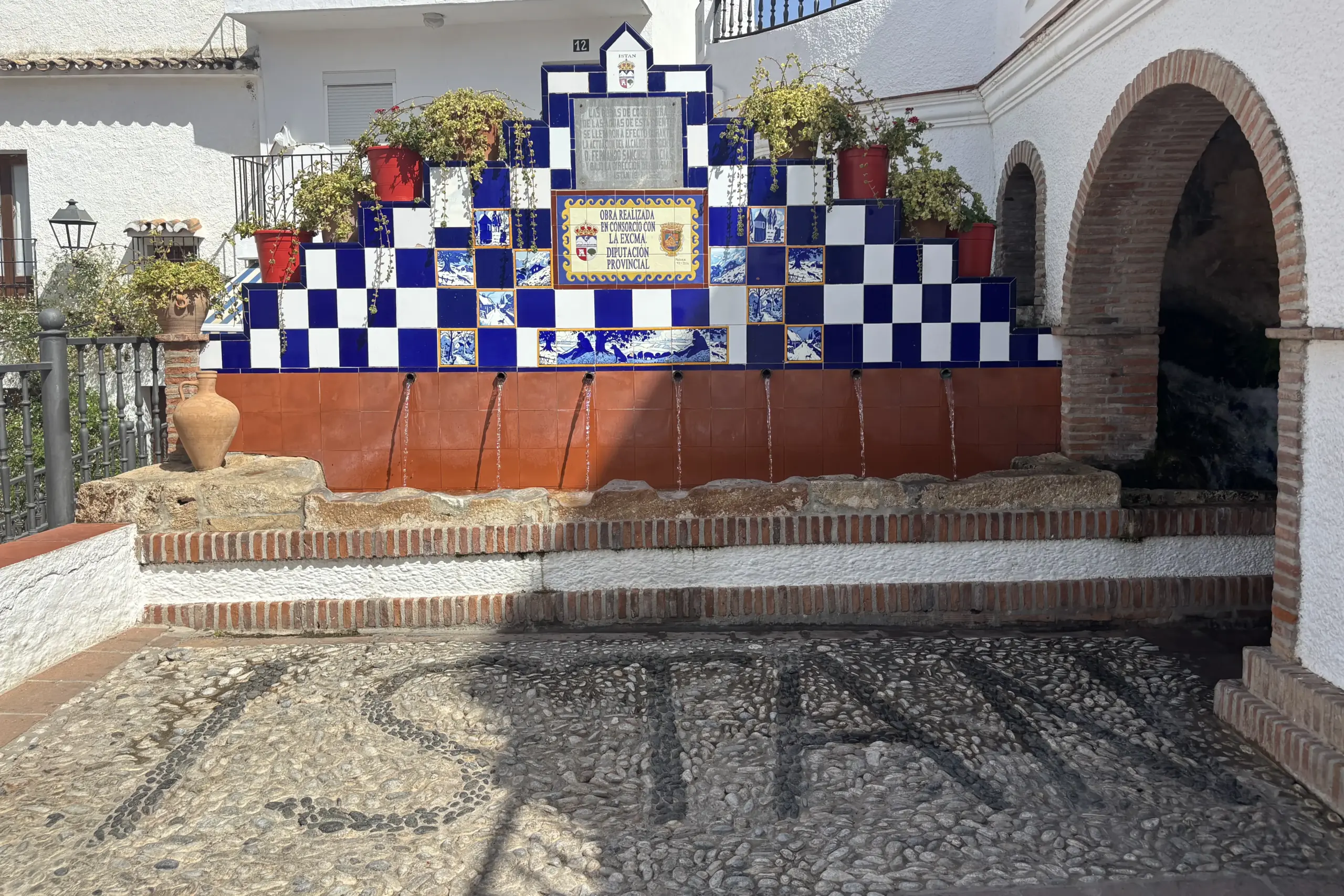
Since you are just a stone’s throw from Istán, it is worth spending a little time in this delightful pueblo blanco, home to Río Verde: its history is far more eventful than its peaceful appearance might suggest — from the Morisco revolt in the 16th century to its fountains and “cañitos”, which have earned it the nickname “village of water”. It deserves an article of its own, which we will cover separately: for now, it is enough to know that, before or after the hike, it is definitely worth stopping for a stroll around the Torre de Escalante, the Iglesia San Miguel, and the village’s two viewpoints — the Mirador de Tajo Banderas and the Mirador de las Herrizas — both overlooking the Embalse de la Concepción. The latter, in particular, offers a beautiful view over this “blue lake” with the white village behind it, perfect for a final photo to round off the day.
Do not miss its restaurants and bars either: the food is really good. And after a 5 km walk, a cerveza with a few tapas is something we all deserve! We tried Entre Sierras and El Barón, following the recommendation of the supermarket assistant, but as it was already almost 4 p.m., both were about to close the kitchen — so we opted for Restaurante y Bar Troyano, which fortunately was still serving food, and we ate really well!
How long is the Río Verde in Istán route?
The short route we did, starting from Aparcamiento Charco del Canalón, is around
4.5-5 km in total there and back, with some variation depending on the route you choose.
It should not be confused with the PR-A 280 Istán – Charco del Canalón, the official trail
that starts directly from the village of Istán and is around 7.2 km one way.
Where can you park for Charco del Canalón?
We started from the
Aparcamiento Charco del Canalón
,
a small unpaved car park near Vado de Bornoque, with space for roughly 10-15 cars.
It is also an access point for several casas rurales, so be careful not to block the way.
Do you have to walk through the river?
No. You can choose between
two very different routes
:
the ruta acuática, which follows Río Verde directly, or the trail along the dirt track,
which allows you to reach Charco del Canalón while staying mostly dry.
Is Río Verde in Istán suitable for children?
With children, I would mainly consider the dry route.
The full ruta acuática requires more caution, as there are very slippery rocks and some sections
deep enough that you need to be a confident swimmer.
Do you need river shoes?
If you choose the ruta acuática, in my opinion shoes with a good non-slip sole are essential.
Even better if they offer some protection from knocks against rocks and stones, as the riverbed is uneven
and very slippery in several places. In any case, in the
Smart Packing List
section you will find all the details on suitable equipment.
Do you need to book or buy a ticket?
No. For this excursion, no booking or ticket is required.
You simply need to choose the route that suits you best and arrive with the right equipment,
especially if you are planning to walk through the river.
Río Chillar is definitely still a promise we have made to ourselves — an adventure to experience sooner or later, because everything we have heard about it has made us far too curious to give up on the idea. But if you are looking today for an experience that is simple, authentic and, above all, refreshing to escape the heat of the coast, Río Verde in Istán is the right answer — yet another reminder that the Costa del Sol is not just about the sea, but also about canyons, trails and nature-based alternatives that certainly do not end with the Caminito del Rey. No booking is required, no ticket is needed: just suitable shoes, a little care on the more slippery sections, and the desire to dive into the water and the adventure.
For this excursion along Río Verde, having the right equipment is essential. You do not need to carry too much with you, but there are a few items that can really make a difference, especially because part of the route takes place in or alongside the river.
Let’s start with shoes, probably the most important thing of all. I had brought some non-slip water shoes and I have to say that, in terms of grip, they did their job. The downside is that this type of shoe offers little protection from knocks against rocks or stones on the riverbed. So, if I were to do this excursion again following the river route rather than the dry one, I would choose something a little more structured. I found these shoes , which in my opinion offer a good balance between non-slip soles, lightness and better foot protection.
Another thing not to underestimate is the backpack. Bear in mind that you will most likely have your phone, documents, keys and perhaps a few other items with you that you absolutely do not want to get wet. I bought this dry bag for a boat trip and found it useful on Río Verde as well. It is also one of those purchases you can use on many other occasions, for example when going to the beach.
For that same boat trip, I had also bought this waterproof phone case and I recommend it for this excursion too. For your phone and car keys, in fact, I always prefer to have an extra layer of protection, especially when walking in or very close to the water.
As for clothing, choose items that dry quickly: swimwear, a technical T-shirt, sports shorts or, in general, breathable fabrics. I, for example, was wearing completely ordinary gym clothes and, once the river section was over, they dried fairly quickly during the dry route back. If you prefer to play it safe, especially if you are doing the excursion with children, you can of course also bring a full change of clothes.
If you are travelling with children, I would also add a mini first-aid kit. I had not thought of it, but my adventure companion had this kit and, thinking about it, it is a good idea. Not because the route is particularly dangerous, but because with rocks, branches and uneven ground, a small cut or scratch can always happen.
Obviously, do not forget a water bottle. I use this one from Natura and I like it mainly because, as it empties, it can be compressed and takes up less and less space in your backpack. The problem is that it is often sold out; if you cannot find it available, here you can find a similar option .
Sunscreen, a hat and sunglasses are particularly useful if you also decide to take the dry route, where you will be much more exposed to the sun than on the sections in or next to the river. I often carry this sunscreen , which is also convenient because it takes up very little space in the backpack.
If you really do not like the feeling of wet skin, bring a microfibre towel as well. It is the same type I use when travelling to a seaside town, because it takes up little space and, above all, dries very quickly. For an excursion like this, it is definitely more practical than a normal towel.
Finally, put a small waterproof bag for wet clothes in your backpack, so you do not risk soaking everything else on the way back. I had not bought anything specific: I had simply brought a few extra IKEA food bags. It is not a particularly sophisticated solution, but it is extremely practical for keeping damp clothes separate from your other belongings.
I would also add a few snacks: an energy bar, some dried fruit or something simple to eat along the way. It takes up very little space and you never know: hunger may strike at the least convenient moment.
In short, for this excursion the rule is simple: suitable shoes, protection from the water and clothing that dries quickly. Once you have those three things covered, everything else is mainly there to make the day more comfortable.